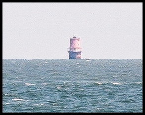
The Thimble Shoals lighthouse was built in 1914 and resembles that of a spark plug. The base of the tower is submerged deep into the sandy shoal that it marks. The tower is three stories high and stands at a height of 55 feet above high tide. A fourth-order Fresnel lens was originally installed in the lantern room to broadcast the light, but it was removed when the Coast Guard automated the lighthouse in 1964. The lens and light system were replaced by an airport style beacon which is powered mainly by solar panels.
The lighthouse has a characteristic of one white flash every ten seconds and remains an important aid to navigation in the Chesapeake Bay, warning ships away from the underwater shoals.
Although the lighthouse is not open to the public, it is accessible up close only by boat. The closest place to view the lighthouse from land is from Ft. Monroe, which is where this photo was taken from. The lighthouse can be seen about three miles away from this location. (To obtain a closer picture, be sure to take a high-powered zoom lens!) A close up view
To visit the Thimble Shoals Lighthouse, take I-64 west from Norfolk toward Hampton. After you exit the tunnel, take the first exit which takes you to Mallory Street. Then turn right on Mellen Street and follow the signs to the fort. Once you reach the entrance to the fort, you must obtain a day pass from the guards. Since the Fort is still an active military post, you may be subject to a vehicle search. The guard will give you directions to reach the Old Point Comfort lighthouse if you need them. Once at the Old Point Comfort Lighthouse, continue on past the lighthouse and you will see a white building with a large parking lot on the right-hand side of the road. Park there and walk out to the sea wall and look to the E/NE and you will see the lighthouse on the horizon.


