In the early 1880’s, vast amounts of phosphate deposits were discovered along the Pearl River. These minerals, used for making fertilizers, were mined, placed on barges, and shipped down river to Port Boca Grande, located along Charlotte Harbor. The phosphate would then be loaded into seaworthy vessels and shipped to other locations for processing. This process greatly increased shipping traffic into and out of Charlotte Harbor. In an effort to protect the shipping trade, in 1890 Congress approved the modest sum of $35,000 to construct a lighthouse on the southern tip of Gasparilla Island to mark the entrance to Charlotte Harbor and its strategic ports.
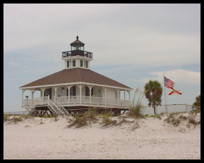
The wooden lighthouse was constructed atop a series of iron pilings that elevated the structure, protecting it from frequent high water caused storms and hurricanes of the gulf. On top and in the center of the one-story dwelling, a square tower was constructed,
To visit the Port Boca Grande Lighthouse, take I-75 to exit 32. Go south on 776 and continue south on 771 towards Gasparila Island. At the southern tip of the Island, there is a parking lot where you can park and walk to the lighthouse.
Directions:
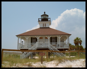
Port Boca Grande Lighthouse
The assistant keeper's quarters sits adjcent to the lighthouse.
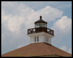
The picturesque lantern with is original Fresnel lens.
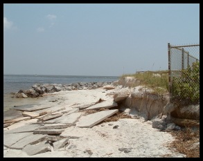
The photo on the left was taken in July of 2001. The photo on the right was taken in July of 2005. The impact from hurricane Charley in 2004 greatly eroded the beach infront of this lighthouse (see photo below), making it difficult to get a good photo of the lighthouse.
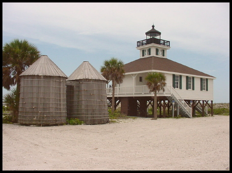
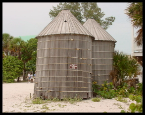
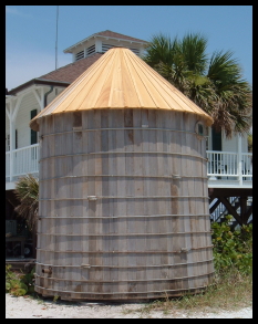
These water cisterns, also seen in the main photo above, were destroyed by hurricane Charley in 2004.
This is the only remaining cistern at the station. It stands next to the assistant keeper's dwelling.
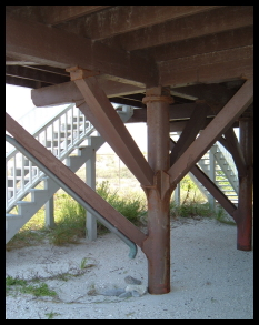
The lighthouse is supported by a series of these metal pilings, helping to protect the structure from high water.
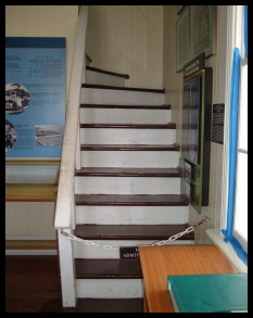
These stairs lead to the gallery and lantern room.
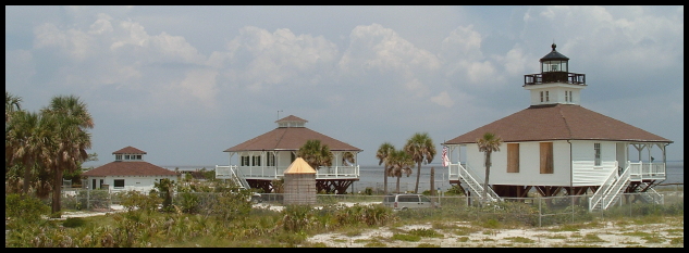
This panoramic view of the light station shows the buildings in relation to each other. Also, note the windows that are still boarded up from the impact of the hurricane.
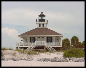
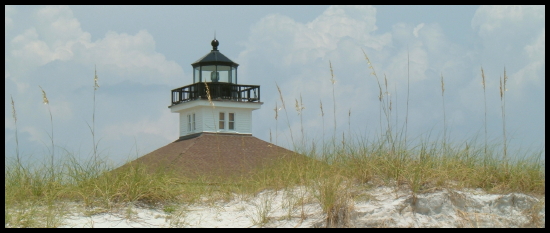
Now standing very close to the beach, the top of the lighthouse rises majestically over the dunes.
Hurricane Charley eroded away much of the beach in front of the light station.
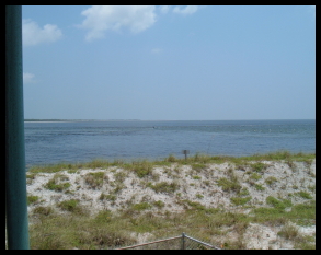
This is the view from the front porch of the lighthouse looking out to the harbor entrance it was built to guide ships into.
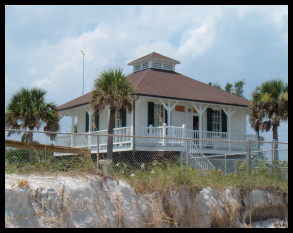
Another view of the lighthouse.
which supported a circular lantern room, which raised the elevation of the light to forty-four feet. The lantern room housed a third and a half order Fresnel lens that was used to broadcast the light out to sea. Its lamps were first lit on December 31, 1890 and shown a white light, interrupted by flashes of red.
Adjacent to the lighthouse, another almost identical building was constructed, minus the tower and lantern, which was used as an assistant keepers dwelling. The Port Boca Grande light station was home to a number of keepers and their families over the years until the Coast Guard abandoned it in 1967. The station was left to the elements and was vandalized until ownership transferred from the federal government to the care of the local county government.
By this time, erosion had chewed away at the shoreline along the southern tip of the island, and the waves were lapping at the support pilings of the lighthouse. The federal government was petitioned by locals to assist in rebuilding the shoreline, but their appeals fell on deaf ears, until it was realized that the eroded sands were filling in the channel and creating sandbars, impeding shipping. The government acted quickly, placing a 265-foot granite jetty near the lighthouse to stop the erosion and protect the southern end of the island, then 100,00 cubic yards of sand into the area, protecting the lighthouse.
In 1980, the Gasparilla Island Conservation and Improvement Association was successful in getting the structure placed on the National Register of Historic Places, and set about raising funds for the restoration of the property. The buildings were fully restored in 1985-1986, including the installations of a 377 mm drum lens, putting the old lighthouse back into service as an active aid to navigation.
Today, the light station is owned by the state and is part of the Gasparilla Island State Park. The lighthouse is currently house to a museum, which is dedicated to teaching the history of the area and the lighthouse.